
Santorini hiking and caldera walks
Walking reveals a different scale of Santorini: a village lane, a change in the caldera view or a route between settlements. Choose the walk for your group and the day’s conditions, rather than assuming every route shown on a map has the same surface, exposure or access. The municipality identifies the caldera-rim route between Imerovigli and Oia and routes around Pyrgos, but its activity overview is not a surveyed trail guide or live access bulletin.
On this page
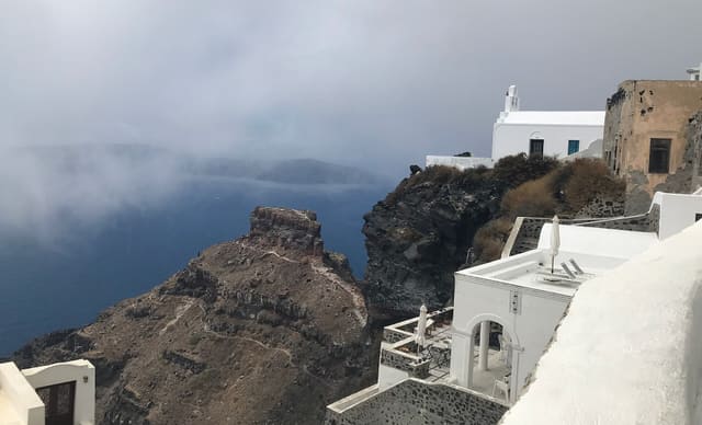
Choose the walk before choosing a distance target
Decide what you want from the outing: views, time between villages or a longer active day. Then check the actual route and an appropriate current map. A familiar route name does not tell you whether every member of the group will be comfortable with the surface, slopes, weather or the distance back to transport.
This guide does not attach an unsupported universal time or difficulty grade to the caldera walk. Pace, stops, starting point and conditions vary. If you need a precise assessment, use a current route guide or qualified local advice and explain the needs of your group.
| Style of outing | Planning approach | Check in advance |
|---|---|---|
| Short caldera outing | Choose a manageable section around your village base | Surface, turning point and route back |
| Imerovigli towards Oia | Treat it as a one-way route only with a return plan | Current route information, forecast and transport |
| Pyrgos and its surroundings | Choose a defined route suited to your group | Access, terrain and the actual destination |
| Village wandering | Use public lanes and keep a flexible pace | Steps, property boundaries and meeting point |
| A route towards an archaeological site | Check the dated operator notice first | Whether access to the intended destination is permitted |
Plan the caldera outing as a complete journey
The municipal activity guide highlights the rim between Imerovigli and Oia. Start by deciding where you will join the route and where you intend to finish. A plan beginning in Fira includes additional village sections; do not assume a description of one section covers every part of a longer day.
Check the return before leaving. If you depend on a bus, use the timetable valid for the date and direction you need. If you arrange a pickup, agree a road meeting point and a practical way to contact the driver. A one-way walk becomes less relaxing when the return is left to guesswork.
- Save the route and important meeting points offline.
- Tell someone where you intend to walk and when you expect to return.
- Keep the option to shorten the outing if the group or conditions require it.
- Do not add a separate demanding detour simply because it appears nearby on a map.
Check conditions and prepare for the actual walk
Use the current forecast and official travel guidance, with particular attention to conditions during the whole outing. UK government travel advice recommends suitable footwear, water, sun protection, route planning and avoiding hiking at the peak hours of sun. Adapt the walk to your abilities and seek appropriate advice if you have health or access concerns.
An early photograph of a quiet path cannot establish today’s surface or restrictions. Follow current signs and local instructions. Keep your phone available, but do not treat a battery-powered map as the only part of the plan; save the route and a practical contact before leaving.
Respect the current destination and access notices
Hellenic Heritage announced that Ancient Thera would close from 27 June 2026 until further notice; that notice remained relevant when checked on 4 November 2026. A generic trail suggestion or seasonal opening table does not establish that the site has reopened. Do not plan an outing that depends on entering it without a new official confirmation.
The municipality also publishes a prohibition on visitor passage and approach to Red Beach because of unstable slopes and unpredictable rockfall. Do not treat a photograph, a crowd or a commercial itinerary as permission to bypass that notice. Follow the restrictions on the ground and use current official information if plans change.
Make shorter walks count
A day does not need to include the longest available route to be worthwhile. Explore a public section of the caldera villages, take time around Pyrgos’s lanes or combine a manageable village visit with a museum. Choose a turning point and keep enough energy and daylight for the return.
For a family or a group with mixed abilities, a short shared outing followed by time at a café can fit better than separating everyone across a long route. Confirm step-free requirements at address level: village names and general route descriptions cannot establish continuous accessibility.
- Choose a route that everyone can comfortably complete.
- Keep lunch or another fixed booking separate from an uncertain finishing time.
- Reassess if the weather, route or access information changes.
- For immediate emergency assistance, use 112 as described by Greek Civil Protection.
Common questions
- How long does the Fira–Oia walk take?
- It depends on the exact start and finish, route, pace, stops and conditions. This guide avoids presenting an unsupported duration as universal. Use current route information and plan the return before setting out.
- Can I hike to Ancient Thera?
- Do not plan a visit that depends on entering the archaeological site while its dated closure remains in force. Hellenic Heritage announced closure from 27 June 2026 until further notice. Check for a new official update before changing that plan.
- Is Red Beach an unrestricted walking stop?
- No. The municipality publishes a prohibition on passage and visitor approach because of unstable slopes and rockfall. Respect current signs and official instructions rather than treating popularity as permission to enter.